The government’s response reaffirms the importance of open-data platforms like Bhuvan in decentralized planning, but also underscores the need for closer integration with local governance for property mapping, asset tracking, and rural development.
NEW DELHI (India CSR) — Several departments and institutions from Jharkhand have been actively using the Bhuvan GIS platform, India’s satellite-based geospatial data portal developed by ISRO. However, the exact applications of the accessed data remain unreported to the Department of Space (DoS).
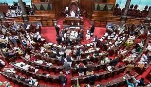
This update was shared by Dr. Jitendra Singh, Union Minister of State (Independent Charge) for Science and Technology, Earth Sciences, and Space, in a written reply to the Rajya Sabha.
The government highlighted Bhuvan’s value for planning but stressed better local integration for mapping and development.
Access to High-Resolution LULC Data
According to Bhuvan access logs, the following agencies from Jharkhand have accessed Land Use Land Cover (LULC) data at 1:10,000 scale, available on the Bhuvan Panchayat portal:
- Jharkhand Space Applications Centre (JSAC)
- Water Resources Department
- Irrigation Department
- Central University of Jharkhand
However, the Department of Space stated it has no information on how this data was applied by these users in their respective planning or governance activities.
DoS has not linked any Gram Panchayat to satellite imagery or mobile GIS services for property recording and monitoring.
Departments from Jharkhand Using Bhuvan Data
A wider list of departments and institutions from Jharkhand that have accessed Bhuvan’s geospatial data includes:
- Forest, Environment and Climate Change Department
- Rural Development Department
- Jharkhand State Rural Road Development Authority
- Director Dairy Development, Ranchi
- Directorate of Fisheries
- Jharkhand State Agriculture Marketing Board, Ranchi
- Minor Irrigation Division, Godda
- Urban Development and Housing Department
- District Administration, Khunti
- Dhanbad Municipal Corporation
- Dumka Nagar Parishad
This highlights widespread use of Bhuvan GIS services by state departments across sectors including forestry, rural roads, fisheries, irrigation, agriculture, and urban planning.
Free Access, But Limited Integration
The Bhuvan portal, developed by the Indian Space Research Organisation (ISRO), provides freely accessible satellite-based geospatial datasets for various users, including government agencies, researchers, and the general public.
Despite this wide accessibility, the Department of Space clarified that no Gram Panchayat in the country has yet been linked to Bhuvan’s satellite imagery or mobile GIS tools for property monitoring or digital land records.
A Tool for Smart Governance
Bhuvan is envisioned as a critical tool for smart governance, enabling planning, monitoring, and transparency in developmental schemes. Its usage by various departments in Jharkhand suggests growing adoption of space-based GIS technologies at the state level.
However, experts highlight the need for better documentation of applications and outcomes to evaluate the true impact of geospatial data use in public service delivery.


